
TL;DR

Get travel and outdoor gear delivered free — and shop member deals
- Fast, free delivery on millions of items
- Access to Prime Big Deal Days deals on October 6–7
- Prime Video, Amazon Music and more included
Transport authorities have introduced a real-time rail network map for Great Britain, providing live updates on train locations and delays. This aims to improve passenger information and operational efficiency.
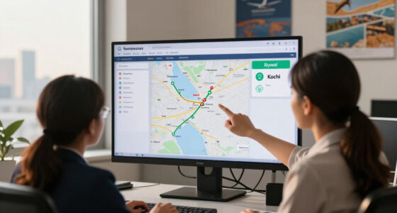
The Department for Transport has officially launched a real-time map of Great Britain’s rail network, providing live updates on train locations, delays, and service disruptions. This development is designed to enhance passenger experience and operational management across the network.
The new digital map, accessible via the National Rail website and mobile apps, displays current train positions, expected arrival and departure times, and real-time service alerts. The project was developed in partnership with several train operators and technology providers, aiming to improve transparency and reduce passenger uncertainty during delays. According to the Department for Transport, the map updates every few minutes, offering a dynamic view of train movements across England, Scotland, and Wales. The launch follows pilot testing in select regions, where feedback indicated improved passenger satisfaction and better crowd management at stations. Officials emphasize that the system is designed to integrate with existing ticketing and information platforms, creating a comprehensive digital travel tool for users.Impacts on Passenger Experience and Rail Operations
This new live map is expected to significantly improve passenger information by providing real-time updates, reducing uncertainty during delays, and helping travelers plan their journeys more effectively. It also offers rail operators a valuable tool for monitoring train movements and managing disruptions more efficiently. The development aligns with broader efforts to digitize transportation infrastructure, making rail travel more transparent and responsive. For commuters, this could mean fewer missed connections and better awareness of service status, especially during peak hours or adverse weather conditions.
As an affiliate, we earn on qualifying purchases.
Background on Digital Innovations in UK Rail Services
Over the past decade, UK rail services have increasingly integrated digital tools to enhance passenger information systems. Previous initiatives include mobile apps for ticketing, live departure boards, and delay compensation schemes. The introduction of a real-time rail map builds on these developments, aiming to unify train tracking data into a single, accessible platform. Pilot programs in regions like the West Midlands and Greater London have demonstrated the potential for real-time tracking to reduce passenger frustration and improve operational oversight. The project is part of a wider government strategy to modernize transport infrastructure and promote smart mobility solutions across the UK.
“This real-time map marks a significant step forward in making rail travel more transparent and user-friendly for millions of passengers across Great Britain.”
— Transport Secretary Mark Harper
real-time train delay alerts Great Britain
As an affiliate, we earn on qualifying purchases.
As an affiliate, we earn on qualifying purchases.
Unresolved Questions About System Integration and Coverage
It is not yet clear how comprehensively the map will cover all regional and rural lines, or how it will integrate with existing ticketing and journey planning tools. Additionally, the system’s reliability during high-traffic periods or technical failures remains to be tested in full-scale operations. Officials have indicated ongoing monitoring and potential updates, but specific performance benchmarks and user feedback are still awaited.
As an affiliate, we earn on qualifying purchases.
Next Steps for Broader Deployment and User Feedback
Following the launch, authorities plan to gather user feedback over the coming months to refine the map’s functionality. Expansion to include more regional lines and integration with other transport modes, such as buses and trams, is also anticipated. Further updates may include enhanced features like predictive delays and personalized alerts, with full nationwide coverage expected within the next year.
As an affiliate, we earn on qualifying purchases.
Key Questions
How can I access the real-time rail map?
The map is available on the National Rail website and through official mobile apps for iOS and Android devices.
Will this system help reduce delays?
While the map provides better information, it does not directly control train schedules. However, improved monitoring can help operators respond more quickly to disruptions, potentially reducing overall delays.
Does the map cover all train lines in Great Britain?
The initial rollout focuses on major routes and regions, with plans to expand coverage to more rural and regional lines over time.
Is the real-time map reliable during peak hours?
Reliability during busy periods is still being assessed, but officials expect the system to perform well based on pilot testing results.
Will this replace existing passenger information services?
The map is designed to complement existing platforms, such as station displays and mobile apps, providing an integrated real-time view.
Source: hn
Fall Picks
fall essentials
As an affiliate, we earn on qualifying purchases.